Fleurieu-Gruppe
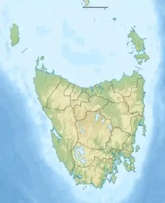
Die Fleurieu-Gruppe (englisch Fleurieu Group)[1][2] ist eine unbewohnte Inselgruppe im Südwesten der Bass-Straße, gelegen unmittelbar vor der Nordwestspitze der australischen Insel Tasmanien. Die Gruppe besteht aus den drei größeren Inseln Robbins Island, Hunter Island und Three Hummock Island sowie einer Vielzahl deutlich kleinerer Inseln beziehungsweise kleinerer Inselgruppen.
| Fleurieu-Gruppe | ||
|---|---|---|
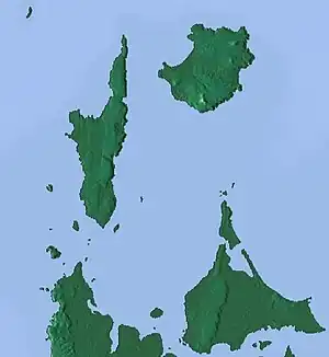 Reliefkarte der Inselgruppe | ||
| Gewässer | Bass-Straße | |
| Geographische Lage | 40° 34′ S, 144° 50′ O | |
| ||
| Anzahl der Inseln | ca. 80 | |
| Gesamte Landfläche | 252 km² | |
| Einwohner | unbewohnt | |

Inseltabelle
| Inselname | Aliasname | Koordinaten | Fläche | Einwohner | Anmerkung |
|---|---|---|---|---|---|
| Robbins Island | 40° 41′ S, 144° 58′ O | 99 | – | ||
| Hunter Island | 40° 31′ S, 144° 45′ O | 71 | – | ||
| Three Hummock Island | 40° 26′ S, 144° 55′ O | 70 | – | ||
| Walker Island | 40° 36′ S, 144° 56′ O | 7 | – | ||
| Kangaroo Island | 40° 42′ S, 144° 50′ O | 1,25 | – | ||
| Trefoil Island | Titima | 40° 38′ S, 144° 41′ O | 1,158 | – | |
| Bird Island | 40° 36′ S, 144° 43′ O | 0,61 | – | ||
| Montagu Island | 40° 45′ S, 144° 55′ O | 0,56 | – | ||
| Petrel Islands | 40° 34′ S, 144° 56′ O | 0,3 | – | Inselgruppe, 6 Inseln | |
| Stack Island | 40° 36′ S, 144° 47′ O | 0,237 | – | ||
| Steep Island | Steep Head | 40° 34′ S, 144° 41′ O | 0,216 | – | |
| Albatross Island | 40° 23′ S, 144° 39′ O | 0,18 | – | ||
| Black Pyramid Rock | 40° 28′ S, 144° 21′ O | 0,14 | – | ||
| Penguin Island | 40° 35′ S, 144° 49′ O | 0,0346 | – | ||
| Harbour Islands | 40° 38′ S, 144° 44′ O | 0,0313 | – | Inselgruppe, ca. 20 Inseln | |
| Howie Island | 40° 44′ S, 144° 59′ O | 0,03 | – | ||
| South Black Rock | 40° 34′ S, 144° 36′ O | 0,02 | – | ||
| Seacrow Island | 40° 37′ S, 144° 44′ O | 0,0156 | – | ||
| Little Trefoil Island | 40° 39′ S, 144° 42′ O | 0,0064 | – | ||
| Edwards Island | 40° 36′ S, 144° 47′ O | 0,0056 | – | ||
| Dugay Island | 40° 36′ S, 144° 47′ O | 0,0044 | – | ||
| Henderson Islands | 40° 38′ S, 144° 44′ O | 0,0041 | – | Inselgruppe, ca. 30 Inseln | |
| Bears Island | 40° 26′ S, 144° 50′ O | 0,0034 | – | ||
| Nares Rocks | 40° 35′ S, 144° 41′ O | 0,0027 | – | Inselgruppe, ca. 15 Inseln |
Einzelnachweise
- Fleurieu Group, Australia. In: geonames.org. Abgerufen am 6. Mai 2020 (englisch).
- Sailing Directions (enroute): East Coast of Australia and New Zealand. S. 63 (books.google.de)

This article is issued from Wikipedia. The text is licensed under Creative Commons - Attribution - Sharealike. Additional terms may apply for the media files.